By Scott Nicol
How does waiving the Endangered Species Act in Hawaii help secure the U.S. – Mexico border?
Simple. It doesn’t.
But that obvious fact is irrelevant to Representative Rob Bishop of Utah, author of the National Security and Federal Lands Protection Act (HR 1505). Bishop claims that the Department of Homeland Security (DHS) cannot enforce immigration laws without violating the rest of our nation’s laws, so his bill waives 36 federal laws within 100 miles of the U.S. – Mexico border, the U.S. – Canada border, and all U.S. coastlines, for anything that DHS may want to do.
Most of the laws that HR 1505 tosses aside, including the Endangered Species Act, Migratory Bird Treaty Act, and Safe Drinking Water Act, protect the environment, but it also waives laws like the Farmland Policy Protection Act and the American Indian Religious Freedom Act.
This bill is an expansion of the Real ID Act, which gave the Secretary of Homeland Security the authority to waive local, state, and federal laws to build walls along the southern border.
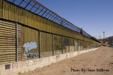
The existing Real ID Act waivers, which HR 1505 expands, have caused tremendous environmental damage. To build border walls 530,000 cubic yards of rock was blasted from mountainsides in the Otay Mountain Wilderness Area; walls have caused serious flooding in the Organ Pipe Cactus National Monument; and walls fragment the Lower Rio Grande Valley National Wildlife Refuge, which was established for the preservation of endangered ocelots. Without the waiver, these walls would be illegal.
Bishop’s bill would also give DHS the run of all federally owned lands, in all 50 states, with absolutely no restrictions. Has a lack of access to the Everglades, or Hawaii’s Volcanoes National Park, or the lawn around the Statue of Liberty, prevented DHS from securing the southern border?
Not according to the Border Patrol.
The irony is that the Border Patrol, which operates under DHS’ umbrella, has not asked for the power to overrule land managers or ignore environmental laws. Last spring the Government Accountability Office found that, “Most agents reported that land management laws have had no effect on Border Patrol’s overall measure of border security.”
When Rep. Bishop introduced a similar bill last year Brandon Judd of the National Border Patrol Council said, “I would definitely look and see if there are some restrictions that are too restrictive. But to get rid of all restrictions, you would destroy the land.”
Representative Bishop has a long history of attacking protected lands and environmental regulations. He is currently pushing for a repeal of the Antiquities Act and a ban on new National Monuments. HR 1505 is just more of the same.
This Wednesday the National Security and Federal Lands Protection Act will be up for a vote in the House Natural Resources Committee, which Rep. Bishop, in a bit of Orwellian irony, chairs. Packed with Tea Party darlings like Bishop, the bill is almost certain to pass and be sent on to the full House of Representatives.
This is the week to contact your representatives and tell them that HR 1505 is not about protecting our nation. It is an assault on federal lands and environmental laws using border security as a convenient cover, nothing more.
For more information, visit www.sierraclub.org/borderlands.
Tuesday, October 4, 2011


Friday, September 16, 2011
CBP Willing to Risk Flooding to Erect New Walls in Roma, Rio Grande City and Los Ebanos
By Scott Nicol
It was just over a year ago that the rising waters of the Rio Grande prompted the mandatory evacuation of Los Ebanos, Texas. Residents rushed to grab what they could before floodwaters cut off the town.
Before the flood, Customs and Border Protection (CBP) was pressuring the U.S. half of the International Boundary Water Commission (USIBWC) to approve the construction of border walls through Los Ebanos, as well as Rio Grande City and Roma, that could have worsened the flooding. CBP had even gone so far as to request that the US half of the International Boundary Water Commission act “unilaterally” and approve walls in the floodplain despite the objections of the Mexican half.
The plans for border walls drafted after the passage of the Secure Fence Act showed South Texas on the receiving end of 69 miles of border wall in 21 disconnected sections. The westernmost three sections, designated O-1, O-2, and O-3, were to be through the communities of Roma, Rio Grande City, and Los Ebanos.
In 2008 the US International Boundary Water Commission made it clear that any walls built along the Rio Grande must comply with US-Mexico treaties. The Real ID Act allowed the Department of Homeland Security (DHS), Customs and Border Protection’s parent agency, to waive all federal, state, and local laws, but not treaties. Walls built in the flood plain adjacent to the Rio Grande might deflect flood waters towards Mexico, causing flood damage to Mexican communities. Deflection might also cause the river to settle into a new channel farther to the south, which would effectively change the location of the US-Mexico boundary. Either of these would be a treaty violation.
In Cameron County and most of Hidalgo our treaty obligations meant that border walls could not be built between the existing flood control levees and the river, so walls were constructed on, in, or north of the levees. Those walls are, for the most part, finished. But unlike the downriver sections, Roma, Rio Grande City, and Los Ebanos do not have USIBWC flood control levees. The border walls in these three communities would therefore be in the flood plain.
Because of the wall’s likely flood impacts USIBWC rejected these three sections of border wall.
A few days after the 2008 elections CBP informed Representative Cuellar, whose district encompasses these communities, that these border wall sections were “on hold.” At the time Cuellar said, “This is a big victory.” He went on to tell the Associated Press, “We're hoping that this will allow us to work with the next president to find ... alternative methods for security."
Representative Cuellar’s constituents also hoped that that would be the last they would hear of plans to wall off their towns from the river, but in a May, 2010 report on the Secure Border Initiative (which includes both solid and “virtual” border walls) the Government Accountability Office stated, “CBP plans to construct an additional 14 miles of pedestrian fencing in the Rio Grande Valley sector.” These 14 miles are the combined Roma, Rio Grande City, and Los Ebanos sections.
Documents uncovered by the Sierra Club through a Freedom of Information Act request over the last year demonstrate that, in fact, the Department of Homeland Security and Customs and Border Protection continued to push for the construction of these walls, and were willing to disregard our treaty obligations and likely problems with flooding to do so.
A Customs and Border Protection “Fence Status Brief” dated April 27, 2009 reveals that to build the previously rejected walls CBP had decided upon a new plan. They would not change the design or location of the walls, or, better yet, give up on them entirely. Instead it says, “the new strategy involves developing a new floodplain model” and that, unlike the old model approved by USIBWC that “predicted noteworthy floodplain impacts from the fence,” “this model will demonstrate the impacts of the proposed fence will be minimal.”
The verb tense - "this model will demonstrate" - is important. It appears that CBP determined the outcome in advance, rather than commissioning an honest, unbiased model that would accurately describe the effects of structures built in the floodplain.
The “new flood plain model”, prepared by Baker Engineering, was completed in December 2009. Presented to CBP eight months after their fence status brief forecast its findings, its conclusion fit the earlier prediction precisely. The “noteworthy floodplain impacts” of building border walls in a floodplain that were predicted just a year earlier disappeared; instead, Baker now claimed that walls would have a “minimal effect on the Rio Grande floodplain.”
Baker decided this without even knowing what type of border wall design would be used. In 2008, CBP proposed a number of designs that were touted as either allowing floodwaters to pass through without being dammed up, or able to be removed before rising water reached them. USIBWC rejected all of these unrealistic schemes. In their 2009 report Baker modeled the border wall as an 18’ high, impermeable wall, with the specific design, whether concrete or steel, posts or mesh or slabs, to be determined later. Since CBP apparently told Baker what the outcome of their modeling would be before they began, it seems that such details were unimportant.
One striking conclusion of Baker’s “new flood plain model” was that in the communities of Roma, Rio Grande City, and Los Ebanos, border walls would “split” the flooding river. It states that for each wall segment, “Downstream of the flow split location, the flow continues in a north branch and a south branch on either side of the fence. The flow combines downstream of the point where the fence ends.”
This splitting is intentional. In the case of Rio Grande City, the wall was modeled with a 500 foot-wide opening in the middle specifically intended to split flood waters and send a portion of them north. Diverting water to the north of the border wall, into property on the US side of the river, means that less is deflected into Mexico. In this way CBP hopes to avoid flooding Mexican communities, and possibly pushing the Rio Grande into a new channel. Walls built in a floodplain will either deflect or divert floodwater, and the only real question is who is going to be on the receiving end.
Each of these wall sections begins upstream of a town and ends downstream of it. They begin close to the river, then the river and wall get farther apart before coming back together. So flood water that might not have reached properties where the proposed wall is farthest from the river will, with a wall in place, have “split” floodwaters channeled directly to them.
This is particularly striking for the Los Ebanos section. The community of Los Ebanos is nestled at the top of a deep bend in the river. The proposed wall would begin next to the Rio Grande at the top of this bend. While the river turns and heads due south, away from homes and the local school, the wall heads due east, directly towards them. That means that water that might have otherwise followed the river and flowed away from Los Ebanos will be split off by the wall, and be diverted into it. On the other side of town, instead of allowing the split flood waters to pour back into the Rio Grande, the wall makes a ninety degree turn, from east to north. Water that had been split off from the flooded river would therefore be bottled up in Los Ebanos.
A Customs and Border Protection Fence Status Brief dated January 20, 2010, written following the presentation of the “new flood plain model” to the Army Corps of Engineers and USIBWC, says that, “[acting USIBWC Commissioner] Ruth agreed no additional modeling is required and to ‘informally’ discuss the fence segments with the new Mexican IBWC Commissioner to determine if he will support.” The brief goes on to state that, “If it appears Mexico will continue to oppose fencing, CBP/DHS and IBWC/DOS [Department of State] to discuss potential unilateral decision to proceed with construction.”
A “unilateral decision” regarding the Rio Grande floodplain, taken by the US half of the International Boundary Water Commission in the face of opposition by the Mexican half, would be a serious treaty violation. The United States would essentially be challenging Mexico to try to stop us from building illegal walls.
On January 21, 2010, acting USIBWC Commissioner Ruth stepped aside, and Edward Drusina became the new commissioner. On his first day in office Commissioner Drusina wrote a letter to David Aguilar, the acting Commissioner of Customs and Border Protection. He stated that, after examining the model that CBP had commissioned, “the USIBWC is not in a position to approve construction of the O-1, O-2 and O-3 fence projects.”
Rather than accept the fact that walls built in the Rio Grande floodplain will have unacceptable impacts, CBP repeatedly pressed the USIBWC to reverse its decision. On February 2, 2010, Aguilar responded to Drusina, “we respectfully request that the USIBWC and Department of State reconsider your position and approve a unilateral decision to allow us to proceed with the design and construction of the O-1, O-2 and O-3 fence segments.”
On July 20, just one week after the flooding Rio Grande forced the mandatory evacuation of Los Ebanos, CBP presented a briefing to the State Department on these three border wall sections. During the briefing CBP claimed that they had already spent “+$1M in “design analysis” costs”, and said that, “we need IBWC and Department of State’s support for an unilateral decision to proceed with the fence construction.”
USIBWC stood firm, and on September 17, 2010, Comissioner Drusina again denied CBP permission to build new walls in the Rio Grande flood plain. CBP continued to push back, and a month later the new CBP Commissioner, Alan Bersin, wrote to USIBWC, asking that they reconsider and complaining about “Mexico’s recent opposition to border fencing regardless of hydraulic modeling results.”
Bersin’s October 2010 letter to USIBWC is the most recent document uncovered by the Sierra Club’s Freedom of Information Act request. The Club was told that to obtain newer documents another request would have to be filed. One has, but it may take months for us to begin receiving more documents.
We have learned through a recent conversation with representatives of the USIBWC and State Department that following the October 2010 letter Commissioners Bersin and Drusina held at least two meetings to discuss the Roma, Rio Grande City, and Los Ebanos walls. As a result of those meetings Baker Engineering was commissioned to develop yet another flood model. That model was completed last spring, and was reviewed by the Army Corps. of Engineers and USIBWC over the summer. It has not been released to the public.
While we hope that USIBWC continues to act in the best interests of the residents of these three communities and live up to its treaty obligations in the face of pressure from Customs and Border Protection, we have no guarantees. The discussions between these two agencies are being held behind closed doors, with landowners and community leaders kept out of the room. It may be months before we are able to see a copy of the latest flood model, and the only announcement that new border walls have been approved may be the arrival of construction crews.
US Representative Henry Cuellar, who represents Roma, Rio Grande City, and Los Ebanos in Washington, should ensure that his constituents are kept informed and given a seat at the table when walls that could channel flood waters into their homes and property are discussed. As the ranking member of the House Homeland Security Subcommittee on Border and Maritime Security, he has the power to demand that CBP hold open public hearings in each of these communities. Customs and Border Protection owes residents the decency of a face to face explanation, before they build new border walls that could put people’s lives and properties at risk.
It was just over a year ago that the rising waters of the Rio Grande prompted the mandatory evacuation of Los Ebanos, Texas. Residents rushed to grab what they could before floodwaters cut off the town.
Before the flood, Customs and Border Protection (CBP) was pressuring the U.S. half of the International Boundary Water Commission (USIBWC) to approve the construction of border walls through Los Ebanos, as well as Rio Grande City and Roma, that could have worsened the flooding. CBP had even gone so far as to request that the US half of the International Boundary Water Commission act “unilaterally” and approve walls in the floodplain despite the objections of the Mexican half.
The plans for border walls drafted after the passage of the Secure Fence Act showed South Texas on the receiving end of 69 miles of border wall in 21 disconnected sections. The westernmost three sections, designated O-1, O-2, and O-3, were to be through the communities of Roma, Rio Grande City, and Los Ebanos.
In 2008 the US International Boundary Water Commission made it clear that any walls built along the Rio Grande must comply with US-Mexico treaties. The Real ID Act allowed the Department of Homeland Security (DHS), Customs and Border Protection’s parent agency, to waive all federal, state, and local laws, but not treaties. Walls built in the flood plain adjacent to the Rio Grande might deflect flood waters towards Mexico, causing flood damage to Mexican communities. Deflection might also cause the river to settle into a new channel farther to the south, which would effectively change the location of the US-Mexico boundary. Either of these would be a treaty violation.
In Cameron County and most of Hidalgo our treaty obligations meant that border walls could not be built between the existing flood control levees and the river, so walls were constructed on, in, or north of the levees. Those walls are, for the most part, finished. But unlike the downriver sections, Roma, Rio Grande City, and Los Ebanos do not have USIBWC flood control levees. The border walls in these three communities would therefore be in the flood plain.
Because of the wall’s likely flood impacts USIBWC rejected these three sections of border wall.
A few days after the 2008 elections CBP informed Representative Cuellar, whose district encompasses these communities, that these border wall sections were “on hold.” At the time Cuellar said, “This is a big victory.” He went on to tell the Associated Press, “We're hoping that this will allow us to work with the next president to find ... alternative methods for security."
Representative Cuellar’s constituents also hoped that that would be the last they would hear of plans to wall off their towns from the river, but in a May, 2010 report on the Secure Border Initiative (which includes both solid and “virtual” border walls) the Government Accountability Office stated, “CBP plans to construct an additional 14 miles of pedestrian fencing in the Rio Grande Valley sector.” These 14 miles are the combined Roma, Rio Grande City, and Los Ebanos sections.
Documents uncovered by the Sierra Club through a Freedom of Information Act request over the last year demonstrate that, in fact, the Department of Homeland Security and Customs and Border Protection continued to push for the construction of these walls, and were willing to disregard our treaty obligations and likely problems with flooding to do so.
A Customs and Border Protection “Fence Status Brief” dated April 27, 2009 reveals that to build the previously rejected walls CBP had decided upon a new plan. They would not change the design or location of the walls, or, better yet, give up on them entirely. Instead it says, “the new strategy involves developing a new floodplain model” and that, unlike the old model approved by USIBWC that “predicted noteworthy floodplain impacts from the fence,” “this model will demonstrate the impacts of the proposed fence will be minimal.”
The verb tense - "this model will demonstrate" - is important. It appears that CBP determined the outcome in advance, rather than commissioning an honest, unbiased model that would accurately describe the effects of structures built in the floodplain.
The “new flood plain model”, prepared by Baker Engineering, was completed in December 2009. Presented to CBP eight months after their fence status brief forecast its findings, its conclusion fit the earlier prediction precisely. The “noteworthy floodplain impacts” of building border walls in a floodplain that were predicted just a year earlier disappeared; instead, Baker now claimed that walls would have a “minimal effect on the Rio Grande floodplain.”
Baker decided this without even knowing what type of border wall design would be used. In 2008, CBP proposed a number of designs that were touted as either allowing floodwaters to pass through without being dammed up, or able to be removed before rising water reached them. USIBWC rejected all of these unrealistic schemes. In their 2009 report Baker modeled the border wall as an 18’ high, impermeable wall, with the specific design, whether concrete or steel, posts or mesh or slabs, to be determined later. Since CBP apparently told Baker what the outcome of their modeling would be before they began, it seems that such details were unimportant.
One striking conclusion of Baker’s “new flood plain model” was that in the communities of Roma, Rio Grande City, and Los Ebanos, border walls would “split” the flooding river. It states that for each wall segment, “Downstream of the flow split location, the flow continues in a north branch and a south branch on either side of the fence. The flow combines downstream of the point where the fence ends.”
This splitting is intentional. In the case of Rio Grande City, the wall was modeled with a 500 foot-wide opening in the middle specifically intended to split flood waters and send a portion of them north. Diverting water to the north of the border wall, into property on the US side of the river, means that less is deflected into Mexico. In this way CBP hopes to avoid flooding Mexican communities, and possibly pushing the Rio Grande into a new channel. Walls built in a floodplain will either deflect or divert floodwater, and the only real question is who is going to be on the receiving end.
Each of these wall sections begins upstream of a town and ends downstream of it. They begin close to the river, then the river and wall get farther apart before coming back together. So flood water that might not have reached properties where the proposed wall is farthest from the river will, with a wall in place, have “split” floodwaters channeled directly to them.
This is particularly striking for the Los Ebanos section. The community of Los Ebanos is nestled at the top of a deep bend in the river. The proposed wall would begin next to the Rio Grande at the top of this bend. While the river turns and heads due south, away from homes and the local school, the wall heads due east, directly towards them. That means that water that might have otherwise followed the river and flowed away from Los Ebanos will be split off by the wall, and be diverted into it. On the other side of town, instead of allowing the split flood waters to pour back into the Rio Grande, the wall makes a ninety degree turn, from east to north. Water that had been split off from the flooded river would therefore be bottled up in Los Ebanos.
A Customs and Border Protection Fence Status Brief dated January 20, 2010, written following the presentation of the “new flood plain model” to the Army Corps of Engineers and USIBWC, says that, “[acting USIBWC Commissioner] Ruth agreed no additional modeling is required and to ‘informally’ discuss the fence segments with the new Mexican IBWC Commissioner to determine if he will support.” The brief goes on to state that, “If it appears Mexico will continue to oppose fencing, CBP/DHS and IBWC/DOS [Department of State] to discuss potential unilateral decision to proceed with construction.”
A “unilateral decision” regarding the Rio Grande floodplain, taken by the US half of the International Boundary Water Commission in the face of opposition by the Mexican half, would be a serious treaty violation. The United States would essentially be challenging Mexico to try to stop us from building illegal walls.
On January 21, 2010, acting USIBWC Commissioner Ruth stepped aside, and Edward Drusina became the new commissioner. On his first day in office Commissioner Drusina wrote a letter to David Aguilar, the acting Commissioner of Customs and Border Protection. He stated that, after examining the model that CBP had commissioned, “the USIBWC is not in a position to approve construction of the O-1, O-2 and O-3 fence projects.”
Rather than accept the fact that walls built in the Rio Grande floodplain will have unacceptable impacts, CBP repeatedly pressed the USIBWC to reverse its decision. On February 2, 2010, Aguilar responded to Drusina, “we respectfully request that the USIBWC and Department of State reconsider your position and approve a unilateral decision to allow us to proceed with the design and construction of the O-1, O-2 and O-3 fence segments.”
On July 20, just one week after the flooding Rio Grande forced the mandatory evacuation of Los Ebanos, CBP presented a briefing to the State Department on these three border wall sections. During the briefing CBP claimed that they had already spent “+$1M in “design analysis” costs”, and said that, “we need IBWC and Department of State’s support for an unilateral decision to proceed with the fence construction.”
USIBWC stood firm, and on September 17, 2010, Comissioner Drusina again denied CBP permission to build new walls in the Rio Grande flood plain. CBP continued to push back, and a month later the new CBP Commissioner, Alan Bersin, wrote to USIBWC, asking that they reconsider and complaining about “Mexico’s recent opposition to border fencing regardless of hydraulic modeling results.”
Bersin’s October 2010 letter to USIBWC is the most recent document uncovered by the Sierra Club’s Freedom of Information Act request. The Club was told that to obtain newer documents another request would have to be filed. One has, but it may take months for us to begin receiving more documents.
We have learned through a recent conversation with representatives of the USIBWC and State Department that following the October 2010 letter Commissioners Bersin and Drusina held at least two meetings to discuss the Roma, Rio Grande City, and Los Ebanos walls. As a result of those meetings Baker Engineering was commissioned to develop yet another flood model. That model was completed last spring, and was reviewed by the Army Corps. of Engineers and USIBWC over the summer. It has not been released to the public.
While we hope that USIBWC continues to act in the best interests of the residents of these three communities and live up to its treaty obligations in the face of pressure from Customs and Border Protection, we have no guarantees. The discussions between these two agencies are being held behind closed doors, with landowners and community leaders kept out of the room. It may be months before we are able to see a copy of the latest flood model, and the only announcement that new border walls have been approved may be the arrival of construction crews.
US Representative Henry Cuellar, who represents Roma, Rio Grande City, and Los Ebanos in Washington, should ensure that his constituents are kept informed and given a seat at the table when walls that could channel flood waters into their homes and property are discussed. As the ranking member of the House Homeland Security Subcommittee on Border and Maritime Security, he has the power to demand that CBP hold open public hearings in each of these communities. Customs and Border Protection owes residents the decency of a face to face explanation, before they build new border walls that could put people’s lives and properties at risk.
Wednesday, September 14, 2011
Congressional Push Continues to Gut Environmental Protections Along U.S. Borders
The Center for Biological Diversity has issued the following press release. No Border Wall is in complete agreement, and urges rational members of Congress to reject McCain's amendment to the DHS appropriations bill, along with similar measures in the House, most notably HR 1505.
TUCSON, Ariz.— Under the guise of border security, Sen. John McCain (R-Ariz.) offered an amendment to the Department of Homeland Security appropriations bill today that would grant border-enforcement agencies free rein on federal lands within 300 miles of the U.S.-Mexico border. After criticism from colleagues in his own party that the 300-mile limit went far beyond the scope of border-enforcement activities, McCain scaled it back to 100 miles, and the amendment was added to the bill.
“Politicians are playing games with important border-security legislation at the expense of laws that protect clean air, water and endangered species,” said Randy Serraglio, a conservation advocate at the Center for Biological Diversity. “This amendment is unnecessary, unwanted and threatens significant harm to the wildlife, natural landscapes and people of the border region.”
The McCain amendment introduced today, similar to a bill proposed earlier this year by McCain and Sen. Jon Kyl (R-Ariz.), does not specifically name any laws, but its guarantee of unfettered access for border-enforcement agencies on federal lands effectively neutralizes protections afforded by the Endangered Species Act, Clean Air Act and Clean Water Act. Existing law permits essential border-security activities even in designated wilderness areas, and an existing memorandum of understanding between Homeland Security and the Department of the Interior provides for cooperation between land managers and border agencies.
“Despite repeated statements and congressional testimony from border-security agencies that they neither want nor need the authority granted in this amendment, radical anti-environment forces in Congress continue to push this hoax on the American people,” said Serraglio. “The losers in this game will be jaguars, ocelots, Sonoran pronghorn and residents of border communities that will no longer benefit from fundamental protections that allow them to live and thrive in a healthy environment.”
The nonpartisan Government Accountability Office concluded in a recent report that access to federal lands has not been limited in 22 of 26 sectors along the border, and that the only problems that have occurred in other sectors have been “minor delays.” Meanwhile, between 8,000 and 20,000 miles of wildcat roads have been blazed through a wilderness area in southern Arizona’s Cabeza Prieta National Wildlife Refuge, a majority of which, in recent years, has been caused by enforcement activities, according to a July report by the U.S. Fish and Wildlife Service.
“This amendment pretends to address a problem that does not exist,” said Serraglio. “Clearly, access to federal lands for border-security personnel is not a significant issue in achieving operational control of the border. At best, the McCain amendment is a case of political grandstanding.”
“The false premise inherent in this proposal is that border security and a healthy environment are somehow mutually exclusive,” said Serraglio. “The truth is just the opposite. It has been shown time and again that collaboration between land managers and security agencies enhances both border security and protection of the diverse and vibrant landscapes of the borderlands.”
http://www.biologicaldiversity.org/news/press_releases/2011/border-security-09-14-2011.html
TUCSON, Ariz.— Under the guise of border security, Sen. John McCain (R-Ariz.) offered an amendment to the Department of Homeland Security appropriations bill today that would grant border-enforcement agencies free rein on federal lands within 300 miles of the U.S.-Mexico border. After criticism from colleagues in his own party that the 300-mile limit went far beyond the scope of border-enforcement activities, McCain scaled it back to 100 miles, and the amendment was added to the bill.
“Politicians are playing games with important border-security legislation at the expense of laws that protect clean air, water and endangered species,” said Randy Serraglio, a conservation advocate at the Center for Biological Diversity. “This amendment is unnecessary, unwanted and threatens significant harm to the wildlife, natural landscapes and people of the border region.”
The McCain amendment introduced today, similar to a bill proposed earlier this year by McCain and Sen. Jon Kyl (R-Ariz.), does not specifically name any laws, but its guarantee of unfettered access for border-enforcement agencies on federal lands effectively neutralizes protections afforded by the Endangered Species Act, Clean Air Act and Clean Water Act. Existing law permits essential border-security activities even in designated wilderness areas, and an existing memorandum of understanding between Homeland Security and the Department of the Interior provides for cooperation between land managers and border agencies.
“Despite repeated statements and congressional testimony from border-security agencies that they neither want nor need the authority granted in this amendment, radical anti-environment forces in Congress continue to push this hoax on the American people,” said Serraglio. “The losers in this game will be jaguars, ocelots, Sonoran pronghorn and residents of border communities that will no longer benefit from fundamental protections that allow them to live and thrive in a healthy environment.”
The nonpartisan Government Accountability Office concluded in a recent report that access to federal lands has not been limited in 22 of 26 sectors along the border, and that the only problems that have occurred in other sectors have been “minor delays.” Meanwhile, between 8,000 and 20,000 miles of wildcat roads have been blazed through a wilderness area in southern Arizona’s Cabeza Prieta National Wildlife Refuge, a majority of which, in recent years, has been caused by enforcement activities, according to a July report by the U.S. Fish and Wildlife Service.
“This amendment pretends to address a problem that does not exist,” said Serraglio. “Clearly, access to federal lands for border-security personnel is not a significant issue in achieving operational control of the border. At best, the McCain amendment is a case of political grandstanding.”
“The false premise inherent in this proposal is that border security and a healthy environment are somehow mutually exclusive,” said Serraglio. “The truth is just the opposite. It has been shown time and again that collaboration between land managers and security agencies enhances both border security and protection of the diverse and vibrant landscapes of the borderlands.”
http://www.biologicaldiversity.org/news/press_releases/2011/border-security-09-14-2011.html
Monday, August 29, 2011
New Study: Border Hysteria Imperils Wildlife
by Dan Millis
In a Congress plagued by immigration hysteria, none is more gravely afflicted than South Carolina’s Republican Senator Jim DeMint. Twice in two weeks he added border pork to Senate bills, both times calling for 300-plus miles of walls to be imposed between the U.S. and Mexico. These are the fourth and fifth times in less than two years that he has made such attempts.
Delirious and angry lawmakers like DeMint seem oblivious to the 650 miles of barriers and walls that already occupy the Southwest’s borderlands, exacting high costs on taxpayers and public lands. Another side effect these lawmakers suffer is an acute indifference to the impacts caused by their border madness.
A new study in the Diversity and Distributions journal identifies 49 species put most at risk by border walls and areas of intensive human land use along the U.S.-Mexico border. The study only considers amphibian, reptile, and non-volant (don't fly) mammal species, and identifies California, the Sky Islands, the Gulf Coast as the three regions most heavily impacted.
One unique aspect of this study is that it doesn’t just look at current impacts wrought by existing border walls and areas with a heavy human footprint. Potential future impacts from border wall expansions such as those proposed by DeMint are also taken into consideration, and the results are sobering:

This graph from the study shows a horizontal base line representing our 2,000 mile border with Mexico. The three faint vertical lines in the left half of the graph represent the state borders between California, Arizona, New Mexico, and Texas. The fatter horizontal line sitting atop the baseline shows where the taller “pedestrian” (10-25 feet tall) border walls are located along the border.
Then there is the vertical ‘species’ scale, which includes only species from the sample set that have already been listed as threatened, either binationally or by the International Union for the Conservation of Nature. The dashed line represents how many of these already-threatened species are put in grave danger by existing “pedestrian” border walls in each geographic location along the border. You’ll notice that there are few such species, which may be expected when working with such a small sample set of species to begin with.
However, the solid line is much less benign, with the number of vulnerable species spiking most dramatically here in Arizona (to the right [East] of first faint vertical line [CA-AZ border]). This line represents the number of already threatened species that would be pushed to the brink if proposals like DeMint’s were passed and border walls came to occupy even more precious habitat.

A key finding of the study states, "The REAL ID Act should be amended to reinstate environmental regulation of border security efforts." The REAL ID waiver of more than 30 vital federal protection laws along the border allowed walls to be built in violation of the Wilderness Act, the Endangered Species Act, and more.
Dan Millis is a Sierra Club Borderlands campaign organizer. To learn more about the Sierra Club's Borderlands Campaign visit http://sierraclub.org/borderlands/
Monday, August 15, 2011
Our Worst Fears about the Border Wall Come True
By Stefanie Herweck
More human beings would die alone in remote deserts. Endangered species would be pushed to the brink. These were the fears that led humanitarians, environmentalists, and border residents to object to the walls along the U.S.-Mexico border called for by the Secure Fence Act of 2006. With 650 miles built, this summer has brought news that these fears are tragically coming true.
The journey taken by migrant men, women and children who set out across the U.S.-Mexico border has always been risky. But border walls have rerouted migrants away from the safety of urban areas and forced them to walk for greater distances over treacherous mountains and through searing deserts. All too easily they can become fatigued, dehydrated, and unable to go on. In too many cases, they die alone in remote areas.
This month an Arizona Daily Star analysis found that migrants today are almost three times more likely to die on their journey than people who crossed in 2006, the year before the walls began to go up. In fact, the rate of death—the number of deaths per 100,000 Border Patrol apprehensions—continues to increase even as fewer people are making the trek across the border.
Before the walls, in 2006, there were just 46 known deaths per 100,000 Border Patrol apprehensions. By 2010 the number had jumped to 118 known deaths per 100,000 apprehensions, and so far 2011 already has a death rate of 129 per 100,000.
These human beings are also dying deeper in the desert and much further from roads than ever before. Because of the remoteness of the areas in which they die, many of the bodies discovered are just skeletal remains. Such are the real and tragic consequences of border walls.
The same walls that are pushing crossers deeper into deadly terrain slice though nature preserves that were established to protect endangered species. The Otay Mountain Wilderness Area, Organ Pipe Cactus National Monument, and Lower Rio Grande Valley National Wildlife Refuge have seen critical wildlife habitat divided by walls. Environmentalists have argued that vulnerable species like the ocelot, whose U.S. population is less than 100 individuals in South Texas, would be walled off and trapped in small fragments of habitat. Without sufficient food, water, and potential mates, the population would dwindle.
Now scientists are beginning to uncover just how extensive the wall’s impacts are likely to be on endangered species. A recent article published in the journal Diversity and Distributions found that border walls impact 23 endangered species border-wide. Some species in California are blocked from as much as 75 percent of their ranges, a circumstance that makes the isolated populations extremely vulnerable to disease or natural disasters. The study also found that in South Texas border walls impact between 60 percent and 70 percent of the habitat set aside for endangered ocelots in the Lower Rio Grande Valley National Wildlife Refuge.
In 2008 the Department of Homeland Security (DHS) recognized that the border wall had damaged wildlife refuges along the border, and Congress appropriated $50 million to mitigate the effects of the wall border-wide. Money was promised to the Lower Rio Grande Valley National Wildlife Refuge to purchase land to replace the ocelot habitat that the border walls fragmented. But after DHS withheld the money for years, Congress took back the funds. DHS has no further plans to fix any of the environmental damage that its border walls have caused.
As predicted, the border wall has exacerbated the ongoing humanitarian crisis of migrant deaths and has devastated the environment. Nevertheless, some in Congress are calling for more walls and looking to strip border communities of their environmental protections under the pretense of border security.
Dan Millis has witnessed first-hand the human tragedy and environmental devastation unfolding daily along the U.S.-Mexico border. Shortly after finding the lifeless body of a young girl along a migrant trail in Arizona, Dan was convicted of littering for leaving bottles of clean water along trails in the same area. He now works for the Sierra Club in Tucson fighting on behalf of the people and places victimized by border walls and enforcement-only politics.
Dan will visit Texas' Rio Grande Valley to share his experiences, and discuss the impacts of flawed U.S. border policy and how you can make a difference on Monday evening, August 22nd at 7:00 pm at Galeria 409 in Brownsville and on Tuesday August 23rd at 7:00 pm at St. John the Baptist Parish Hall in San Juan. For more information and directions, visit valleygreenspace.wordpress.com.
As border residents we need to educate ourselves about the terrible consequences of border walls and enforcement-only policies all along the border, and then inform our elected leaders.
Stefanie Herweck is chair of the Lower Rio Grande Valley Sierra Club.
More human beings would die alone in remote deserts. Endangered species would be pushed to the brink. These were the fears that led humanitarians, environmentalists, and border residents to object to the walls along the U.S.-Mexico border called for by the Secure Fence Act of 2006. With 650 miles built, this summer has brought news that these fears are tragically coming true.
The journey taken by migrant men, women and children who set out across the U.S.-Mexico border has always been risky. But border walls have rerouted migrants away from the safety of urban areas and forced them to walk for greater distances over treacherous mountains and through searing deserts. All too easily they can become fatigued, dehydrated, and unable to go on. In too many cases, they die alone in remote areas.
This month an Arizona Daily Star analysis found that migrants today are almost three times more likely to die on their journey than people who crossed in 2006, the year before the walls began to go up. In fact, the rate of death—the number of deaths per 100,000 Border Patrol apprehensions—continues to increase even as fewer people are making the trek across the border.
Before the walls, in 2006, there were just 46 known deaths per 100,000 Border Patrol apprehensions. By 2010 the number had jumped to 118 known deaths per 100,000 apprehensions, and so far 2011 already has a death rate of 129 per 100,000.
These human beings are also dying deeper in the desert and much further from roads than ever before. Because of the remoteness of the areas in which they die, many of the bodies discovered are just skeletal remains. Such are the real and tragic consequences of border walls.
The same walls that are pushing crossers deeper into deadly terrain slice though nature preserves that were established to protect endangered species. The Otay Mountain Wilderness Area, Organ Pipe Cactus National Monument, and Lower Rio Grande Valley National Wildlife Refuge have seen critical wildlife habitat divided by walls. Environmentalists have argued that vulnerable species like the ocelot, whose U.S. population is less than 100 individuals in South Texas, would be walled off and trapped in small fragments of habitat. Without sufficient food, water, and potential mates, the population would dwindle.
Now scientists are beginning to uncover just how extensive the wall’s impacts are likely to be on endangered species. A recent article published in the journal Diversity and Distributions found that border walls impact 23 endangered species border-wide. Some species in California are blocked from as much as 75 percent of their ranges, a circumstance that makes the isolated populations extremely vulnerable to disease or natural disasters. The study also found that in South Texas border walls impact between 60 percent and 70 percent of the habitat set aside for endangered ocelots in the Lower Rio Grande Valley National Wildlife Refuge.
In 2008 the Department of Homeland Security (DHS) recognized that the border wall had damaged wildlife refuges along the border, and Congress appropriated $50 million to mitigate the effects of the wall border-wide. Money was promised to the Lower Rio Grande Valley National Wildlife Refuge to purchase land to replace the ocelot habitat that the border walls fragmented. But after DHS withheld the money for years, Congress took back the funds. DHS has no further plans to fix any of the environmental damage that its border walls have caused.
As predicted, the border wall has exacerbated the ongoing humanitarian crisis of migrant deaths and has devastated the environment. Nevertheless, some in Congress are calling for more walls and looking to strip border communities of their environmental protections under the pretense of border security.
Dan Millis has witnessed first-hand the human tragedy and environmental devastation unfolding daily along the U.S.-Mexico border. Shortly after finding the lifeless body of a young girl along a migrant trail in Arizona, Dan was convicted of littering for leaving bottles of clean water along trails in the same area. He now works for the Sierra Club in Tucson fighting on behalf of the people and places victimized by border walls and enforcement-only politics.
Dan will visit Texas' Rio Grande Valley to share his experiences, and discuss the impacts of flawed U.S. border policy and how you can make a difference on Monday evening, August 22nd at 7:00 pm at Galeria 409 in Brownsville and on Tuesday August 23rd at 7:00 pm at St. John the Baptist Parish Hall in San Juan. For more information and directions, visit valleygreenspace.wordpress.com.
As border residents we need to educate ourselves about the terrible consequences of border walls and enforcement-only policies all along the border, and then inform our elected leaders.
Stefanie Herweck is chair of the Lower Rio Grande Valley Sierra Club.
Friday, July 29, 2011
New Amendments Threaten Protected Lands
US representative Gosar has introduced two amendments (no. 20 and 55) to the Department of the Interior's annual appropriations bill that would do tremendous damage to our nation's protected federal lands. Representative Gosar’s (R-AZ) amendment No. 20 is an extreme attack on public lands even more overreaching than recent controversial legislation (H.R. 1505). Under this amendment the U.S. Border Patrol would be exempted from any regulation that would “impede or obstruct” patrol activities on every acre of federal land throughout the United States, putting national treasures at risk and throwing away a century of laws designed to protect our natural resources.
What federal lands would be put at risk?
• All of them. This amendment decimates environmental and other protections on every single acre of federally owned lands, from areas in the southwest already at risk from Border Patrol Activities, like the Cabeza Prieta National Wildlife Refuge in Arizona, to places far from the border, including the Grand Canyon, Yellowstone National Park, and the Cape Hatteras National Seashore.
• This amendment is NOT restricted to areas near the southwest border or even to areas near all borders, as past legislation has proposed.
What laws would be overturned?
• All of them. This amendment is even more overreaching in its impact on federal lands than the controversial H.R. 1505 because it is not restricted to a long list of environmental regulations, but prevents the enforcement of any regulation, even those put in place for safety and other reasons.
• Other regulations that could be completely ignored are those that support economic development, allowing Border Patrol to interfere with grazing, mining, and drilling for oil and gas on public lands.
What Border Patrol activities would be exempted from any oversight?
• All of them. The amendment does not clearly define what “impede or obstruct” means or who would decide whether a law or regulation meets this standard and could therefore be ignored.
• The amendment is even more overreaching than past bills on the Border Patrol because it does not limit exempted activities to “operational control” – or activities specifically intended to prevent illegal entry into the country. Instead it exempts all “patrol activities” which, without definition, could mean any activity undertaken by the Border Patrol.
• This will create conflict between agencies that have begun to work very effectively together to resolve issues surrounding Border Patrol activities.
Is the amendment even needed by the Border Patrol?
• No. The amendment would override multiagency coordination that has been occurring on Federal lands since a 2006 Memorandum of Agreement between the Departments of Homeland Security, Interior, and Agriculture that has led to increased cooperation and leveraged resources.
• 22 out of 26 Border Patrol stations on the southern border with Mexico report that the border security of their area of operation has not been affected by land management laws beyond some minor delays. Instead, factors like rugged terrain—and not access delays or restrictions—have the highest impact on operational control.
• Exemptions already exist that allow Border Patrol Officers in pursuit to continue onto any federal land regardless of regulations or laws. Other exemptions have also been established administratively to ensure the Border Patrol has the access necessary to secure the border.
In addition, Rep. Gosar has also introduced amendment No. 55, another extreme attack on federal lands. Similar to amendment No. 20, this amendment would exempt the Border Patrol from any environmental review, from protecting clean air and water, from honoring and respecting the history and culture of native people, from preserving biodiversity, and more.
Who isn’t hurt by this amendment?
Representative Gosar’s friends in industries like oil and gas drilling, grazing, mining, and logging are taken off the hook in this updated version of amendment No. 20. Amendment No. 20 exempts the Border Patrol from “any regulation” meaning that rules allowing for development and resources extraction could also be trampled by any Border Patrol activities. Amendment No. 55, however, spares these special interests and instead focuses its attack on the environment, biodiversity, and native people.
What environmental and cultural laws would be overturned?
A similar list of laws to that found in H.R. 1505 is included in the amendment. These laws represent a century of bipartisan efforts to protect the environment, intelligently manage public lands, and demonstrate respect for historical and cultural sites.
The exempted laws include:
The National Environmental Policy Act of 1969 (42 U.S.C. 4321 et seq.)
The Endangered Species Act of 1973 (16 U.S.C. 1531 et seq.)
The Clean Water Act (33 U.S.C. 1251 et seq.)
The National Historic Preservation Act (16 U.S.C. 470 et seq.).
The Migratory Bird Treaty Act (16 U.S.C. 703 et seq.)
The Clean Air Act (42 U.S.C. 7401 et seq.).
The Archeological Resources Protection Act of 1979 (16 U.S.C. 18 470aa et seq.).
The Safe Drinking Water Act (42 U.S.C. 300f et seq.).
The Noise Control Act of 1972 (42 U.S.C. 4901 et seq.).
The Solid Waste Disposal Act (42 U.S.C. 6901 et seq.).
The Comprehensive Environmental Response, Compensation, and Liability Act of 1980 (42 U.S.C. 9601 et seq.)
The Archaeological and Historic Preservation Act' and the Archaeological Recovery Act (16 U.S.C. 469 et seq.).
The Antiquities Act (16 U.S.C. 431 et seq.).
The Historic Sites, Buildings, and Antiquities Act (16 U.S.C. 461 et seq.)
The Farmland Protection Policy Act (7 U.S.C. 4201 et seq.).
The Coastal Zone Management Act of 1972 (16 U.S.C. 1451 et seq.).
The Federal Land Policy and Management Act of 1976 (43 U.S.C. 1701 et seq.).
The Wilderness Act (16 U.S.C. 1131 et seq.).
The Bald Eagle Protection Act of 1940 (16 U.S.C. 668 et seq.).
The Native American Graves Protection and Repatriation Act (25 U.S.C. 3001 et seq.).
The American Indian Religious Freedom Act (42 U.S.C. 1996 et seq.).
The Religious Freedom Restoration Act of 1993 (42 U.S.C. 2000bb et seq.).
The Federal Grant and Cooperative Agreement Act of 1977 (31 U.S.C. 6303 et seq.)
What Species would be impacted?
The bill waives compliance with all provisions of the ESA on federal lands. Species throughout the nation that would be impacted include
In the Southwest
• Mexican spotted owl
• Desert tortoise
• Jaguar
• Ocelot
• Sonoran pronghorn
• Chiricahua leopard frog
Elsewhere in the country
• Florida Panther
• Canada lynx
• Polar bear
• Hawaii akepa (honeycreeper)
• Leatherback sea turtle
• West Indian manatee
What federal lands would be put at risk?
• All of them. This amendment decimates environmental and other protections on every single acre of federally owned lands, from areas in the southwest already at risk from Border Patrol Activities, like the Cabeza Prieta National Wildlife Refuge in Arizona, to places far from the border, including the Grand Canyon, Yellowstone National Park, and the Cape Hatteras National Seashore.
• This amendment is NOT restricted to areas near the southwest border or even to areas near all borders, as past legislation has proposed.
What laws would be overturned?
• All of them. This amendment is even more overreaching in its impact on federal lands than the controversial H.R. 1505 because it is not restricted to a long list of environmental regulations, but prevents the enforcement of any regulation, even those put in place for safety and other reasons.
• Other regulations that could be completely ignored are those that support economic development, allowing Border Patrol to interfere with grazing, mining, and drilling for oil and gas on public lands.
What Border Patrol activities would be exempted from any oversight?
• All of them. The amendment does not clearly define what “impede or obstruct” means or who would decide whether a law or regulation meets this standard and could therefore be ignored.
• The amendment is even more overreaching than past bills on the Border Patrol because it does not limit exempted activities to “operational control” – or activities specifically intended to prevent illegal entry into the country. Instead it exempts all “patrol activities” which, without definition, could mean any activity undertaken by the Border Patrol.
• This will create conflict between agencies that have begun to work very effectively together to resolve issues surrounding Border Patrol activities.
Is the amendment even needed by the Border Patrol?
• No. The amendment would override multiagency coordination that has been occurring on Federal lands since a 2006 Memorandum of Agreement between the Departments of Homeland Security, Interior, and Agriculture that has led to increased cooperation and leveraged resources.
• 22 out of 26 Border Patrol stations on the southern border with Mexico report that the border security of their area of operation has not been affected by land management laws beyond some minor delays. Instead, factors like rugged terrain—and not access delays or restrictions—have the highest impact on operational control.
• Exemptions already exist that allow Border Patrol Officers in pursuit to continue onto any federal land regardless of regulations or laws. Other exemptions have also been established administratively to ensure the Border Patrol has the access necessary to secure the border.
In addition, Rep. Gosar has also introduced amendment No. 55, another extreme attack on federal lands. Similar to amendment No. 20, this amendment would exempt the Border Patrol from any environmental review, from protecting clean air and water, from honoring and respecting the history and culture of native people, from preserving biodiversity, and more.
Who isn’t hurt by this amendment?
Representative Gosar’s friends in industries like oil and gas drilling, grazing, mining, and logging are taken off the hook in this updated version of amendment No. 20. Amendment No. 20 exempts the Border Patrol from “any regulation” meaning that rules allowing for development and resources extraction could also be trampled by any Border Patrol activities. Amendment No. 55, however, spares these special interests and instead focuses its attack on the environment, biodiversity, and native people.
What environmental and cultural laws would be overturned?
A similar list of laws to that found in H.R. 1505 is included in the amendment. These laws represent a century of bipartisan efforts to protect the environment, intelligently manage public lands, and demonstrate respect for historical and cultural sites.
The exempted laws include:
The National Environmental Policy Act of 1969 (42 U.S.C. 4321 et seq.)
The Endangered Species Act of 1973 (16 U.S.C. 1531 et seq.)
The Clean Water Act (33 U.S.C. 1251 et seq.)
The National Historic Preservation Act (16 U.S.C. 470 et seq.).
The Migratory Bird Treaty Act (16 U.S.C. 703 et seq.)
The Clean Air Act (42 U.S.C. 7401 et seq.).
The Archeological Resources Protection Act of 1979 (16 U.S.C. 18 470aa et seq.).
The Safe Drinking Water Act (42 U.S.C. 300f et seq.).
The Noise Control Act of 1972 (42 U.S.C. 4901 et seq.).
The Solid Waste Disposal Act (42 U.S.C. 6901 et seq.).
The Comprehensive Environmental Response, Compensation, and Liability Act of 1980 (42 U.S.C. 9601 et seq.)
The Archaeological and Historic Preservation Act' and the Archaeological Recovery Act (16 U.S.C. 469 et seq.).
The Antiquities Act (16 U.S.C. 431 et seq.).
The Historic Sites, Buildings, and Antiquities Act (16 U.S.C. 461 et seq.)
The Farmland Protection Policy Act (7 U.S.C. 4201 et seq.).
The Coastal Zone Management Act of 1972 (16 U.S.C. 1451 et seq.).
The Federal Land Policy and Management Act of 1976 (43 U.S.C. 1701 et seq.).
The Wilderness Act (16 U.S.C. 1131 et seq.).
The Bald Eagle Protection Act of 1940 (16 U.S.C. 668 et seq.).
The Native American Graves Protection and Repatriation Act (25 U.S.C. 3001 et seq.).
The American Indian Religious Freedom Act (42 U.S.C. 1996 et seq.).
The Religious Freedom Restoration Act of 1993 (42 U.S.C. 2000bb et seq.).
The Federal Grant and Cooperative Agreement Act of 1977 (31 U.S.C. 6303 et seq.)
What Species would be impacted?
The bill waives compliance with all provisions of the ESA on federal lands. Species throughout the nation that would be impacted include
In the Southwest
• Mexican spotted owl
• Desert tortoise
• Jaguar
• Ocelot
• Sonoran pronghorn
• Chiricahua leopard frog
Elsewhere in the country
• Florida Panther
• Canada lynx
• Polar bear
• Hawaii akepa (honeycreeper)
• Leatherback sea turtle
• West Indian manatee
Thursday, July 7, 2011
How much do border walls cost? Just the facts:
There is a wide cost range for the construction of pedestrian border walls, resulting from factors which include labor (some sections were built by members of the National Guard, while others were built by private contractors); topography; remote vs. urban locations; land purchases and condemnations; materials (wall sections built in the 1990’s used scrap metal, obtained from the military for free, while more recent sections have required the purchase of concrete, steel, etc.); and the design that is being utilized.
In October 2008 the Houston Chronicle reported that “The Army Corps of Engineers estimated that the amount spent for pedestrian fencing has jumped 88 percent since February to $7.5 million per mile. The costs for vehicle barriers have increased 40 percent to $2.8 million per mile, according to the GAO.”
“As border fence lags, costs, controversy rise” by Stewart Powell, Houston Chronicle, October 10, 2008
http://www.chron.com/disp/story.mpl/metropolitan/6052544.html
In January, 2009, the Government Accountability Office (GAO) reported that costs for sections built up to that point ranged from $400,000 to $15.1 million. They also noted that these cost estimates were not independently verified and, “An Independent Auditor's Report on DHS's Fiscal Year 2008 Financial Statements found that CBP did not have adequate policies and procedures in place to properly account for steel purchases and construction of the U.S. border fence in an accurate and timely manner. As a result, for several months throughout the year, CBP’s financial statements did not accurately reflect the construction activity.”
Secure Border Initiative Fence Construction Costs, United States Government Accountability Office, January 29, 2009
http://www.gao.gov/new.items/d09244r.pdf
The GAO’s January 2009 report only included border wall sections that had been completed, not those which were under construction or in various stages of planning.
Sections that were later constructed included the 3.6 miles of pedestrian border wall built through the Otay Mountain Wilderness Area, at a cost of $57.7 million, averaging just over $16 million per mile.
“$57.7-million fence added to an already grueling illegal immigration route” by Richard Marosi, Los Angeles Times, February 15, 2010
http://articles.latimes.com/2010/feb/15/local/la-me-fence15-2010feb15
Also unfinished at the time were the border wall and earthen berm blocking Smuggler’s Gulch, near San Diego, which cost $59 million for 3.5 miles, averaging $16.8 million per mile.
“A Barren Promise at the Border” by Rob Davis, Voice of San Diego, October 22, 2009http://www.voiceofsandiego.org/environment/article_13330282-1245-5e49-bd68-5a10237c9f44.html
According to the GAO it will cost an estimated $75 million per year to maintain border walls. As of mid-May 2009, the fence had been breached more than 3,300 times, with costs to repair each breach averaging $1,300.
Secure Border Initiative: Technology Deployment Delays Persist and the Impact of Border Fencing Has Not Been Assessed, Government Accountability Office, September 2009
http://www.gao.gov/new.items/d09896.pdf
In 2011 the GAO stated that “CBP estimated that the border fencing had a life cycle of 20 years and over these years, a total estimated cost of about $6.5 billion to deploy, operate, and maintain the fencing and other infrastructure. According to CBP, during fiscal year 2010, there were 4,037 documented and repaired breaches of the fencing and CBP spent at least $7.2 million to repair the breaches, or an average of about $1,800 per breach.”
BORDER SECURITY: DHS Progress and Challenges in Securing the U.S. Southwest and Northern Borders, United States Government Accountability Office, March 30, 2011
http://www.gao.gov/new.items/d11508t.pdf
In the spring and summer of 2011, CBP replaced 2.77 miles of existing “landing mat” fence in Nogales, which had suffered numerous breaches, with “bollard” fencing, at a cost of $11.6 million.
“Barrier Rebuilt” by Margaret Regan, Tucson Weekly, June 23, 2011
http://www.tucsonweekly.com/tucson/barrier-rebuilt/Content?oid=3028495
In 2010 the GAO reported that “Since fiscal year 2006, DHS has received about $4.4 billion in appropriations for SBI, including about $2.5 billion for physical fencing and related infrastructure, about $1.5 billion for virtual fencing (e.g., surveillance systems) and related infrastructure (e.g., towers), and about $300 million for program management.”
SECURE BORDER INITIATIVE: DHS Needs to Strengthen Management and Oversight of Its Prime Contractor, United States Government Accountability Office, October, 2010
http://www.gao.gov/new.items/d116.pdf
In October 2008 the Houston Chronicle reported that “The Army Corps of Engineers estimated that the amount spent for pedestrian fencing has jumped 88 percent since February to $7.5 million per mile. The costs for vehicle barriers have increased 40 percent to $2.8 million per mile, according to the GAO.”
“As border fence lags, costs, controversy rise” by Stewart Powell, Houston Chronicle, October 10, 2008
http://www.chron.com/disp/story.mpl/metropolitan/6052544.html
In January, 2009, the Government Accountability Office (GAO) reported that costs for sections built up to that point ranged from $400,000 to $15.1 million. They also noted that these cost estimates were not independently verified and, “An Independent Auditor's Report on DHS's Fiscal Year 2008 Financial Statements found that CBP did not have adequate policies and procedures in place to properly account for steel purchases and construction of the U.S. border fence in an accurate and timely manner. As a result, for several months throughout the year, CBP’s financial statements did not accurately reflect the construction activity.”
Secure Border Initiative Fence Construction Costs, United States Government Accountability Office, January 29, 2009
http://www.gao.gov/new.items/d09244r.pdf
The GAO’s January 2009 report only included border wall sections that had been completed, not those which were under construction or in various stages of planning.
Sections that were later constructed included the 3.6 miles of pedestrian border wall built through the Otay Mountain Wilderness Area, at a cost of $57.7 million, averaging just over $16 million per mile.
“$57.7-million fence added to an already grueling illegal immigration route” by Richard Marosi, Los Angeles Times, February 15, 2010
http://articles.latimes.com/2010/feb/15/local/la-me-fence15-2010feb15
Also unfinished at the time were the border wall and earthen berm blocking Smuggler’s Gulch, near San Diego, which cost $59 million for 3.5 miles, averaging $16.8 million per mile.
“A Barren Promise at the Border” by Rob Davis, Voice of San Diego, October 22, 2009http://www.voiceofsandiego.org/environment/article_13330282-1245-5e49-bd68-5a10237c9f44.html
According to the GAO it will cost an estimated $75 million per year to maintain border walls. As of mid-May 2009, the fence had been breached more than 3,300 times, with costs to repair each breach averaging $1,300.
Secure Border Initiative: Technology Deployment Delays Persist and the Impact of Border Fencing Has Not Been Assessed, Government Accountability Office, September 2009
http://www.gao.gov/new.items/d09896.pdf
In 2011 the GAO stated that “CBP estimated that the border fencing had a life cycle of 20 years and over these years, a total estimated cost of about $6.5 billion to deploy, operate, and maintain the fencing and other infrastructure. According to CBP, during fiscal year 2010, there were 4,037 documented and repaired breaches of the fencing and CBP spent at least $7.2 million to repair the breaches, or an average of about $1,800 per breach.”
BORDER SECURITY: DHS Progress and Challenges in Securing the U.S. Southwest and Northern Borders, United States Government Accountability Office, March 30, 2011
http://www.gao.gov/new.items/d11508t.pdf
In the spring and summer of 2011, CBP replaced 2.77 miles of existing “landing mat” fence in Nogales, which had suffered numerous breaches, with “bollard” fencing, at a cost of $11.6 million.
“Barrier Rebuilt” by Margaret Regan, Tucson Weekly, June 23, 2011
http://www.tucsonweekly.com/tucson/barrier-rebuilt/Content?oid=3028495
In 2010 the GAO reported that “Since fiscal year 2006, DHS has received about $4.4 billion in appropriations for SBI, including about $2.5 billion for physical fencing and related infrastructure, about $1.5 billion for virtual fencing (e.g., surveillance systems) and related infrastructure (e.g., towers), and about $300 million for program management.”
SECURE BORDER INITIATIVE: DHS Needs to Strengthen Management and Oversight of Its Prime Contractor, United States Government Accountability Office, October, 2010
http://www.gao.gov/new.items/d116.pdf
Subscribe to:
Posts (Atom)